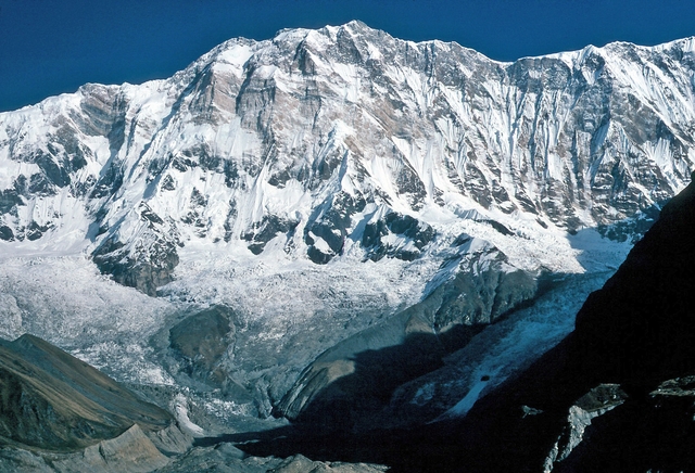
Aconcagua
Mendoza, Argentina, Andes
Oxygen Analysis — Oximeter
Oxygen comparison
Required Preparation
At 6962 m, with 41% oxygen available, perceived effort increases compared to sea level.
How to prepare
- Occasional training: this altitude requires mountaineering experience and specific preparation.
- Regular training: plan multiple days of progressive acclimatization at intermediate altitudes.
- Endurance training: physical fitness alone does not replace acclimatization at these altitudes.
- Consult a mountain medicine specialist before departure.
Route and Trail
Peak Guide
The roof of the Americas. An Andean colossus rising from Argentina's Mendoza Province to 6962 meters, towering over the Principal Cordillera with walls of rock and ice that push the limits of high-altitude mountaineering. Aconcagua is the highest peak in the Americas and the tallest mountain outside Asia — one of the Seven Summits, a goal that draws mountaineers from every continent. Reaching the summit via the Normal Route (northwest ridge) means undertaking a two- to three-week adventure through desert valleys, ice penitentes, and wind-blasted scree slopes, arriving at a point where the air delivers a mere 41% of the oxygen available at sea level.
Quick Facts
| Detail | Value |
|---|---|
| Altitude | 6962 m a.s.l. |
| Massif | Principal Cordillera, Central Andes |
| Names | Aconcagua (IT/EN/ES/FR/DE), アコンカグア (JA) |
| Difficulty | F+ / PD — High-altitude mountaineering, non-technical on the normal route |
| Total elevation gain | ~4012 m from Horcones (2950 m) |
| Total distance | ~75 km round-trip (Normal Route) |
| Duration | 15–20 days (full expedition) |
| Recommended season | December – March (Southern Hemisphere summer) |
| Starting point | Horcones, Parque Provincial Aconcagua entrance (2950 m) |
| Base camp | Plaza de Mulas (4260 m) |
Oxygenation and Acclimatization
At 6962 meters barometric pressure grants a mere 41% of the oxygen available at sea level. Aconcagua places the mountaineer in the extreme altitude zone — where hypoxia is severe and potentially lethal, Acute Mountain Sickness (AMS) is the norm, and the risk of High Altitude Pulmonary Edema (HAPE) and High Altitude Cerebral Edema (HACE) is real even with meticulous acclimatization.
Typical summit SpO₂ ranges between 50 and 65% for well-acclimatized subjects during the two-week approach. These are values that cause mental confusion, extreme breathlessness with every step, and a fatigue that makes the final 400 meters of elevation gain — from the Canaleta to the summit — an experience at the limits of human endurance.
Acclimatization on Aconcagua is a long and structured process. The Normal Route's altitude profile includes progressive stops at Confluencia (3390 m), Plaza de Mulas (4260 m), Camp Canada (4900 m), Nido de Cóndores (5570 m), and Camp Colera/Berlin (5950–6000 m), with daily excursions to higher altitudes followed by descents to sleep lower. A minimum of 7–10 acclimatization days is recommended before the summit attempt.
Adopt diaphragmatic breathing from 3500 meters onward: inhale through the nose for four seconds, exhale through the mouth for six. Above 5000 meters, use pressure breathing: exhale forcefully against pursed lips to maintain alveolar pressure. Drink at least 4–5 liters of water per day — the dry Andean air dehydrates rapidly. If you experience intense headache unresponsive to hydration, persistent nausea, ataxia, or breathlessness at rest, descend immediately — on Aconcagua the descent is always possible along the ascent route, but the time required to reach safe altitudes is significant.
Note: This advice is informational and does not replace medical consultation. Consult a physician specializing in high-altitude medicine before attempting Aconcagua.
The Ascent (Normal Route — Northwest Ridge)
The Normal Route is Aconcagua's most popular and least technical route. It requires no rock or ice climbing, but the combination of extreme altitude, ferocious wind, and intense cold makes it one of the most serious mountaineering challenges in the world. The Viento Blanco — the dreaded white wind — can strike at any time with gusts exceeding 150 km/h, making any movement impossible.
Approach: Horcones → Confluencia
2950 m → 3390 m | Elevation gain: +440 m | Distance: ~8 km | Time: 4–5 hours
From the Parque Provincial Aconcagua entrance at Horcones (2950 m), the route follows a wide, well-marked trail up the Horcones Valley through a desert landscape of ochre mountains and deep blue sky. At Confluencia (3390 m), 1–2 days are spent acclimatizing, with an optional excursion to Plaza Francia (4000 m) to admire Aconcagua's spectacular south face — a wall of rock and ice rising nearly 3000 meters.
Approach: Confluencia → Plaza de Mulas
3390 m → 4260 m | Elevation gain: +870 m | Distance: ~22 km | Time: 7–9 hours
The longest stage of the approach. The route crosses the desolate Upper Horcones Valley, a lunar landscape of moraines and scree fields, with penitentes — ice pinnacles up to 5 meters tall — creating a surreal labyrinth. Plaza de Mulas (4260 m) is the Normal Route's base camp: a small tent city at 4260 meters, with a doctor, satellite communications, and even a small hotel. Several days are spent here acclimatizing with progressive carries to the high camps.
High Camps: Plaza de Mulas → Nido de Cóndores
4260 m → 4900 m → 5570 m | Cumulative elevation gain: +1310 m | Multiple days
From Plaza de Mulas, climbers ascend to Camp Canada (4900 m) and then to Nido de Cóndores (5570 m), carrying supplies and returning to sleep lower. Nido de Cóndores is an exposed and windy high camp with spectacular views of the Andean range. Acclimatization at this stage is crucial: many climbers spend 3–4 nights alternating between Canada and Nido de Cóndores.
High Camp: Nido de Cóndores → Berlin / Colera
5570 m → 5950 m / 6000 m | Elevation gain: +380–430 m | Time: 3–5 hours
The final camp before the summit. Refugio Berlin (5950 m) — a spartan stone and metal structure — and Camp Colera (6000 m) are the launch points for the summit bid. At this altitude, sleep is difficult, appetite vanishes, and every movement requires disproportionate effort. Climbers try to rest a few hours before the pre-dawn departure.
Summit Day: Berlin/Colera → Summit
5950–6000 m → 6962 m → 5950 m | Elevation gain: +962–1012 m / same descent | Time: 8–14 hours
Departure between 3 and 5 a.m. in extreme cold (−20°C to −35°C with wind chill). The route passes Refugio Independencia (6380 m) — a historic ruin, once the highest shelter in the world — and continues on the diagonal traverse toward the dreaded Canaleta: a steep, unstable scree couloir that forms the final obstacle before the summit. The Canaleta is the hardest section — 400 meters of elevation gain on loose rock above 6500 meters, where every step demands immense effort.
At the summit, a small rocky plateau with the Cruz de la Cumbre (summit cross) offers views stretching across the Andean Cordillera to the Pacific on the clearest days. Time at the top is brief: cold, wind, and hypoxia demand a rapid descent along the same ascent route.
Physical Preparation
Aconcagua is not a technically difficult mountain on the normal route — there are no climbing pitches or significant crevasses — but it is the highest mountain outside the Himalayas, and its extreme altitude makes it a serious challenge. The summit success rate hovers around 30–40%, and the limiting factor is almost always altitude — not technique.
| Starting level | Preparation time | Key Phases |
|---|---|---|
| Sedentary / Beginner | Not recommended without prior experience above 5000 m | First gain mountaineering experience at 4000–5000 m (Elbrus, Kilimanjaro). Intense aerobic training for at least 6 months. |
| Regular Hiker | 6–12 months | Experience above 5000 m essential. 7+ day treks with 1000 m+/day elevation gain. Intense aerobic activity 4–5 times per week. |
| Mountaineer with high-altitude experience | 2–3 months | Maintaining high aerobic fitness. Prior experience above 6000 m strongly recommended. |
Equipment
Aconcagua is a mountain with arctic conditions at the summit and a desert climate at the base. Equipment must handle temperatures that can drop below −35°C with strong winds, on scree and hard snow terrain above 5000 m.
Essential:
- High-mountain boots (double or insulated, compatible with semi-automatic/automatic crampons)
- Semi-automatic or automatic crampons (needed if ice on the Canaleta)
- Classic ice axe (50–60 cm)
- Layering system for −35°C: technical base layer, heavy fleece, expedition down jacket, windproof Gore-Tex shell
- Double-layer gloves (liner gloves + expedition mittens)
- Balaclava and glacier goggles (cat. 4)
- Headlamp with lithium batteries
- Trekking poles
- Expedition sleeping bag (comfort −25°C / −30°C)
- Insulated sleeping pad (closed-cell + inflatable)
- SPF 50+ sunscreen and UV lip balm
- Thermos with hot drink for summit day
Recommended:
- Windproof face mask (the Viento Blanco is merciless)
- Pocket pulse oximeter to monitor your SpO₂
- Altitude sickness medication (Acetazolamide/Diamox) — discuss with your doctor
- Chemical hand and toe warmers
- Two-way radio
- High waterproof gaiters
Logistics and Permits
Aconcagua is located in Parque Provincial Aconcagua, Mendoza Province, Argentina. Access is regulated and requires:
- Climbing permit (Permiso de Ascenso): mandatory, issued by the Mendoza provincial government. Purchased online or at the Mendoza office. Cost varies by season and nationality (approximately 600–1000 USD for peak season)
- Evacuation insurance: mandatory, covering high-altitude helicopter rescue
- Park registration: mandatory check-in at the Horcones Ranger Station with permit presentation and equipment verification
Mules transport equipment to Plaza de Mulas; above base camp, climbers must carry everything themselves or hire porters (porteadores). Most participants rely on local agencies that manage logistics, transportation, base camp meals, and guiding.
Historical Notes and Curiosities
Aconcagua is the highest mountain in the Americas, a giant dominating the Andean Cordillera with a majesty that has fascinated explorers and mountaineers since the 19th century. The name may derive from the Quechua Ackon Cahuak ("stone sentinel") or from the Mapudungun Akon-Kahuak ("comes from the other side").
The first ascent: The summit was reached on January 14, 1897 by Swiss guide Matthias Zurbriggen, a member of the expedition led by British explorer Edward FitzGerald. FitzGerald himself never reached the summit due to altitude sickness, but Zurbriggen completed the ascent solo from the high camp. A few days later, Stuart Vines and Nicola Lanti also reached the summit.
Key milestones:
- 1897 — First ascent by Matthias Zurbriggen via the northwest ridge (Normal Route)
- 1934 — First ascent of the east face (Polish Glacier) by a Polish expedition
- 1954 — First ascent of the south face, one of the great walls of the Andes
- 1986 — Reinhold Messner opens a new route on the south face in alpine style
Curiosities:
- Aconcagua is the highest mountain outside Asia — taller than any peak in Europe, Africa, Antarctica, and Oceania
- At 6962 meters, it is one of the Seven Summits and a coveted goal for mountaineers worldwide
- The Viento Blanco (white wind) is the most feared weather phenomenon: cold air masses from the Pacific strike the mountain with devastating gusts, causing hypothermia and frostbite within minutes
- The penitentes — ice and snow pinnacles up to 5 meters tall — are a characteristic formation of Aconcagua and the Andes in general, created by differential solar erosion
- Approximately 3500–4000 climbers attempt the ascent each year, with a success rate of 30–40% — extreme altitude is the primary limiting factor
- The Canaleta, the summit couloir, is considered one of the most demoralizing sections in high-altitude mountaineering: steep, unstable scree above 6500 m where every step feels like the last
- Refugio Independencia (6380 m) was for decades considered the highest shelter in the world — today it is a ruin, but remains a historic landmark
⚠️ Medical disclaimer: The information provided is indicative and based on general physiological data. It does not replace the advice of a physician specializing in high-altitude medicine. Consult a professional before attempting Aconcagua.
Sources and References
The information on this page has been verified from the following sources
Related peaks
Discover other peaks in the same area