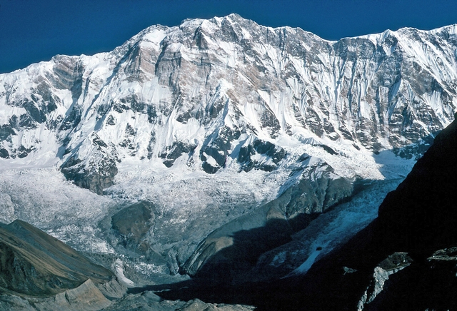
Western Breithorn
Pennine Alps, Aosta Valley / Valais, Italy / Switzerland
Oxygen Analysis — Oximeter
Oxygen comparison
Required Preparation
At 4164 m, with 60% oxygen available, perceived effort increases compared to sea level.
How to prepare
- Occasional training: specific preparation and progressive acclimatization are required before the summit.
- Regular training: plan acclimatization stops and monitor oxygen saturation.
- Endurance training: respect physiological adaptation times even if fitness level is high.
- Consider a sports medical assessment before the ascent.
Route and Trail
Peak Guide
The easiest four-thousander in the Alps. The summit that every year gifts thousands of aspiring alpinists their baptism at extreme altitude, the peak where the border between Italy and Switzerland runs along a snowy ridge at 4164 meters with a direct line of sight to the Matterhorn, Monte Rosa, and Mont Blanc. But behind the reassuring label lurks a treacherous paradox: the Klein Matterhorn cable car catapults the body from 1600 to 3883 meters in thirty minutes, bypassing any form of acclimatization. Every summer this mechanism produces hundreds of cases of Acute Mountain Sickness among people convinced they are embarking on a gentle walk.
Quick Facts
| Detail | Value |
|---|---|
| Altitude | 4164 m a.s.l. |
| Mountain group | Pennine Alps, Italy-Switzerland border |
| Names | Breithorn Occidentale (IT), Western Breithorn (EN), Westliches Breithorn (DE) |
| Difficulty | F (Easy) — maximum slopes of 30–35° on snow/ice |
| Effective elevation gain | ~700 m (from Plateau Rosa / Testa Grigia, 3480 m) |
| Total distance | 7.0 km round-trip |
| Route development | 7.5 km (actual trail distance over glacial terrain) |
| Ascent time | 3–4 hours from Plateau Rosa / Testa Grigia |
| Recommended season | June – September |
| Starting point | Breuil-Cervinia (2006 m) / Zermatt (1620 m) |
| Cable car top station | Testa Grigia / Plateau Rosa (3480 m) |
Oxygenation and Acclimatization
At 4164 meters the Western Breithorn casually clears the four-thousand-meter threshold: barometric pressure delivers a mere 60% of the oxygen available at sea level. This value fully activates the mechanisms of Acute Mountain Sickness — throbbing headache, nausea, dizziness, breathlessness disproportionate to the effort. Typical summit SpO₂ for an acclimatized person ranges between 80 and 86%, which explains the persistent gasping even on moderate slopes.
The Breithorn's problem is not the altitude itself: it is the speed at which you reach it. The Klein Matterhorn cable car lifts the body from roughly 1600 meters to 3883 meters in under thirty minutes. In half an hour, available oxygen plummets from 100% to 63%, without the kidneys, bone marrow, and carotid chemoreceptors having the slightest chance to initiate an adaptive response. Whoever steps out of the cable car is physiologically a lowlander transplanted to nearly four thousand meters with zero warning. This is the trap: the elevation gain on foot is roughly 700 meters, the gradient never extreme, yet the body is in oxygen debt from the very first step.
The most effective defense is spending the previous night at altitude — at the Rifugio Guide del Cervino (3480 m) or at the Rifugio Teodulo (3317 m) — granting your body at least eight hours of partial adaptation. If an overnight stay is not possible, remain at the cable car station for at least 30–40 minutes before setting off, drink generously, and impose a mercilessly slow pace from the first meter. Inhale through your nose in four counts, exhale through your mouth in six. If a headache becomes hammering or confusion, severe nausea, or loss of coordination appear, do not hesitate: descend immediately.
Note: This advice is informational and does not replace medical consultation. Consult a physician specializing in high-altitude medicine before undertaking demanding ascents.
The Ascent (Normal Route from Plateau Rosa)
From the top station of the Testa Grigia cable car (3480 m) you step directly onto the vast Plateau Rosa, the glacial expanse that stretches toward the Breithorn massif. Rope up, strap on your crampons, and form the rope team: from here you are on glacier terrain at all times.
Once on the plateau, crampons bite into compact snow. The glacier is wide and reassuringly gentle in appearance, yet crevasses are present — hidden beneath snow bridges that by late summer become dangerously thin. The direction is east-northeast, toward the unmistakable silhouette of the Breithorn dominating the horizon like a white wave. After approximately one hour of traversal you reach the base of the summit slope.
From here the gradient increases progressively to reach 30–35 degrees on the final stretch. Breathing shortens, calves burn, each step demands a one-breath pause. The summit ridge is broad and snowy with no exposed passages, leading gently to the summit cross at 4164 meters. The panorama is one of the most spectacular in the Alps: the Matterhorn rises less than five kilometers away in a straight line, behind it Mont Blanc closes the western horizon, while to the east the Monte Rosa wall dominates everything with the Capanna Margherita visible to the naked eye. On the clearest days the view extends to Monviso and the Bernese Alps.
The descent retraces the same route. With heavy legs and lungs still gasping at nearly four thousand meters, even the flat stretches of the glacier require a measured pace all the way back to the cable car station.
Physical Preparation
The Western Breithorn is the most accessible ascent in the four-thousander club, yet every year mountain rescue teams respond on this peak with a frequency that contradicts its reputation as an easy summit. The enemy is not technique — the normal route never exceeds grade F — but the combination of sudden hypoxia, dehydration, and underestimation. You need legs accustomed to walking in crampons on slopes of at least 25–30 degrees and an aerobic base that allows you to sustain two hours of continuous effort at 4000 meters without faltering.
| Starting level | Preparation time | Key Phases |
|---|---|---|
| Expert Hiker | 2–3 months | Familiarization with crampons and ice axe. At least one ascent above 3000m. One overnight in a high-altitude hut to test your personal response to altitude. |
| Average Alpinist | 2–4 weeks | Aerobic fitness check on elevation gains at altitude. Rope team drills on glacier terrain. |
The Breithorn is often used as a preparatory summit before harder climbs such as Gran Paradiso, Castore, or the Matterhorn. If this is your first experience above 3500 meters, seriously consider spending the night at Rifugio Guide del Cervino the evening before.
Equipment
The Breithorn is a short but real glacier ascent. The gentleness of the slope does not erase the objective hazards of the glacier.
Essential:
- Sharp 12-point crampons on rigid high-mountain boots
- Classic ice axe
- Harness with daisy chain, glacier rope (minimum 25m), and crevasse rescue kit
- Certified alpine helmet
Recommended:
- Category 4 sunglasses — the glare on Plateau Rosa is blinding even under overcast skies
- SPF 50+ sunscreen and protective lip balm
- Waterproof windproof shell and thermal layer (at 4000m the wind cuts even in July)
- Double-layered gloves and a beanie or balaclava
- Thermos with a hot drink and energy bars
- Pocket pulse oximeter to monitor your SpO₂ during the ascent
Brief Historical Notes
The first documented ascent of the Western Breithorn dates to August 13, 1813, when Henry Maynard reached the summit with guides Joseph-Marie Couttet, Jean Gras, and Jean-Baptiste Erin from the Swiss side. For over a century the climb remained a serious undertaking, requiring long glacier approaches from Zermatt or the Valtournenche valley. The construction of the Klein Matterhorn cable car in 1979, raising the top station to 3883 meters, radically transformed the mountain's profile: from a classic alpine ascent to a "four-thousander for everyone." Today the Breithorn is the most climbed peak above 4000 meters in the Alps, with thousands of ascents each summer. But the mountain does not forgive complacency: the glacier conceals crevasses, weather changes in minutes, and altitude strikes anyone who arrives unprepared. Technical ease has never been synonymous with safety.
⚠️ Medical disclaimer: The information provided is indicative and based on general physiological data. It does not replace the advice of a physician specializing in high-altitude medicine. Consult a professional before high-altitude excursions.
Sources and References
The information on this page has been verified from the following sources
- Gulliver — Breithorn Occidentale via normale da Plateau Rosa
- Vie Normali — Breithorn Occidentale
- Vie Lunghe Valle d'Aosta — Breithorn Occidentale via normale
- InAlto — Breithorn Occidentale dal Rifugio Guide del Cervino
- Verticalife — Salita Breithorn Occidentale con guida
- CAI Carpi — Breithorn Occidentale 4165m via normale
- ICAO Standard Atmosphere (Doc 7488/3)
Related peaks
Discover other peaks in the same area