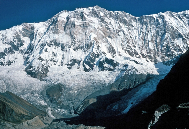
Corno Grande
Gran Sasso d'Italia, Abruzzo, Italy
Oxygen Analysis — Oximeter
Oxygen comparison
Required Preparation
At 2912 m, with 70% oxygen available, perceived effort increases compared to sea level.
How to prepare
- Occasional training: plan gradual acclimatization — resting heart rate will rise at this altitude.
- Regular training: keep a steady pace and watch for mild hypoxia symptoms.
- Endurance training: altitude is manageable with planning — avoid forcing the pace in the first hours.
Route and Trail
Peak Guide
The roof of the Apennines. A crown of limestone rock rising to 2912 meters in the heart of Abruzzo, dominating the Campo Imperatore plateau with a majesty that rivals the great Alpine peaks. Corno Grande is the highest summit of the continental Apennines and shelters within its embrace the Calderone Glacier, the southernmost in Europe — a relic of the last ice age clinging to the basin between its four summits. Climbing Gran Sasso is no ordinary hike: it is a pilgrimage to the wild heart of central Italy.
Quick Facts
| Detail | Value |
|---|---|
| Altitude | 2912 m a.s.l. (Western Summit) |
| Mountain group | Gran Sasso d'Italia, Abruzzo Apennines |
| Summits | Western (2912 m), Eastern (2903 m), Central (2893 m), Torrione Cambi (2875 m) |
| Normal route | From Campo Imperatore via Conca degli Invalidi — EE (Expert Hikers), grade I |
| Elevation gain | ~900 m from Campo Imperatore (2130 m) |
| Distance | ~11 km round trip |
| Ascent time | 3–4 hours |
| Recommended season | July – October |
| Starting point | Campo Imperatore (2130 m) |
| Trail markers | CAI paths 101 and 103 |
Four Summits, One King
Corno Grande is not a single peak but an amphitheater of four summits arranged in a horseshoe around a spectacular basin. The Western Summit (2912 m) is the culminating point of the entire Apennine chain and the objective of the normal route. The Eastern Summit (2903 m), accessible via the spectacular Ricci via ferrata, offers a more technical and adrenaline-charged experience. The Central Summit (2893 m) connects to the eastern one through the Forchetta Sivitilli, while the Torrione Cambi (2875 m), wedged between the central and western summits, is a favorite destination for climbers linking the full four-summit traverse.
The Calderone Glacier
In the basin enclosed between these summits survives the Calderone Glacier, the southernmost in Europe: a remnant of fossil ice suspended between 2680 and 2830 meters, a silent witness to the great Pleistocene glaciations. The permanent snow line at this latitude sits much higher, around 3100 meters: the Calderone survives only thanks to the shade cast by the walls of Corno Grande and Corno Piccolo. Now reduced to a glacial snowfield, it remains a unique climatic and scientific treasure of inestimable value.
Oxygenation and Acclimatization
At 2912 meters barometric pressure yields 70% of the oxygen available at sea level. This places Corno Grande in the moderate-to-high altitude zone: hypoxia is present and noticeable, especially under exertion, but manageable with basic awareness. Typical summit SpO₂ for a fit individual ranges between 85 and 90% — values that can cause mild headache, pronounced breathlessness, and cognitive slowing in unacclimatized subjects.
The risk of Acute Mountain Sickness at this altitude is moderate but not negligible, particularly for those ascending rapidly from lowland without intermediate stops. Starting from Campo Imperatore (2130 m) provides a natural advantage: nearly 800 meters of elevation gain are accumulated gradually on foot, giving the body time to initiate the compensatory ventilatory response. Nonetheless, in the final stretch — the steepest and most demanding — the thinning air makes itself felt with authority.
Adopt a slow, steady pace from the start: the right rhythm is one that allows you to speak without gasping. On the steepest sections of the Conca degli Invalidi and the final gully, use diaphragmatic breathing: inhale through the nose for four seconds, exhale through the mouth for six. If you experience persistent headache, nausea, or dizziness, stop, hydrate, and slow down further. In case of severe symptoms, descend without hesitation.
Note: This advice is informational and does not replace medical consultation. Consult a physician specializing in high-altitude medicine before undertaking demanding ascents.
The Ascent (Normal Route from Campo Imperatore)
From Campo Imperatore to Sella di Monte Aquila You start from the large parking area at Campo Imperatore (2130 m), at the foot of the astronomical observatory and the famous hotel where Mussolini was held prisoner. CAI trail 101 skirts the alpine botanical garden and climbs gently through high-altitude pastures, with the profile of Corno Grande dominating the horizon. In about 45 minutes you reach the Sella di Monte Aquila (2335 m), where you leave trail 101 and take trail 103 to the right, heading toward the summit.
From Sella del Brecciaio to Conca degli Invalidi The path steepens and the terrain changes character: limestone scree and rubble replace the pastures. You gain altitude steadily until you reach the Sella del Brecciaio (2506 m), where you leave the junction for the Brizio via ferrata and the ridge route to the left. You continue on a clearly visible track, ascending increasingly severe scree slopes, until you enter the Conca degli Invalidi (around 2670 m), a natural amphitheater of debris framed by the walls of Corno Grande.
From Conca degli Invalidi to the Summit Here begins the most demanding section. You aim for the steep gully heading northwest, ignoring the turnoffs toward Sella dei Due Corni and Rifugio Franchetti. The ascent becomes severe: you climb over rocks and rubble, using your hands on the steepest passages (grade I), with loose terrain demanding constant attention. You reach the ridge overlooking the Calderone Glacier (around 2770 m), where a breathtaking view opens onto the glacial basin and the Eastern Summit. The final meters follow the western ridge, skirting rocky outcrops on exposed but well-traced ground, until you set foot on the Western Summit of Corno Grande (2912 m) — the roof of the Apennines. On clear days, the gaze sweeps from the Adriatic Sea to the Tyrrhenian, embracing the entire central Apennine chain.
The descent follows the same route. Take particular care on the scree during the descent: the loose terrain is slippery and demands a sure foot.
Physical Preparation
Corno Grande is rated EE but should not be underestimated: the 900 meters of elevation gain develop entirely over mountain terrain with no beaten path in the final stretch, featuring unstable scree and rock passages that require steady footing and basic familiarity with alpine terrain. Mountaineering experience is not required, but good physical fitness and comfort with sustained elevation gain are essential.
| Starting level | Preparation time | Key Phases |
|---|---|---|
| Average Hiker | 2–3 months | Weekly outings with increasing elevation gains (600 to 1000 m). At least two hikes above 2500 m. Familiarization with scree terrain. |
| Expert Hiker | 2–4 weeks | Verify endurance on 900m+ elevation gains and mixed terrain. A preparatory climb such as Monte Amaro on the Majella (2793 m) is ideal. |
Those who have never hiked on steep scree and exposed terrain should build up gradually before attempting Corno Grande. Presolana, Monte Velino, or Monte Amaro are excellent preparatory outings.
Equipment
Corno Grande via the normal route is not a mountaineering ascent, but it remains a serious climb in a high-mountain Apennine environment. Equipment should be chosen with care.
Essential:
- High, rigid trekking boots — the rocky and scree terrain requires ankle support
- Telescopic trekking poles — essential for the descent on scree
- Waterproof windbreaker — weather on Gran Sasso can change with extreme speed
- Thermal layers (fleece or merino wool) — summit temperatures can drop drastically
- At least 1.5 liters of water — there are no sources along the route
Recommended:
- Lightweight helmet — in the final stretch, rockfall risk from hikers above is real
- Category 3–4 sunglasses
- SPF 50+ sunscreen and brimmed hat
- Light gloves and beanie — even in summer the ridge can be freezing
- Pocket pulse oximeter to monitor SpO₂ during the ascent
Historical Notes and Curiosities
Corno Grande boasts one of the earliest documented ascents in the history of European mountaineering, a full two centuries before the conquest of Mont Blanc. On August 19, 1573, the Bolognese military engineer Francesco De Marchi, nearly seventy years old, reached the summit accompanied by local guides — an extraordinary feat for the era, undertaken without any modern equipment and documented with rare precision in his writings. De Marchi's ascent is considered an act of proto-alpinism of exceptional historical value.
For over two centuries the mountain returned to silence, until July 30, 1794, when the Teramo-born naturalist Orazio Delfico climbed Corno Grande from the eastern side with engineer Eugenio Michitelli. Delfico's ascent was the first of a scientific nature: he carried a De Luc barometer to measure the altitude, collected mineral and botanical samples, and published the results in the periodicals of the time. For many decades it was considered the absolute first ascent, until later research restored De Marchi's chronological primacy.
Other key milestones:
- 1934 — Inauguration of the Gran Sasso cable car and the Campo Imperatore Hotel, which opened access to the plateau and transformed Corno Grande into Italy's most popular mountain
- 1943 — On September 12, a German commando led by Otto Skorzeny freed Benito Mussolini from the Campo Imperatore Hotel, in one of the boldest military operations of World War II
- The Calderone Glacier is studied as a climate indicator of global significance: its progressive retreat documents the impact of global warming at Mediterranean latitudes
⚠️ Medical disclaimer: The information provided is indicative and based on general physiological data. It does not replace the advice of a physician specializing in high-altitude medicine. Consult a professional before high-altitude excursions.
Sources and References
The information on this page has been verified from the following sources
- Gulliver — Corno Grande Western Summit from Campo Imperatore
- Planet Mountain — Corno Grande Western Summit via the Calderone
- Trekking Facile — Corno Grande del Gran Sasso 2912m Normal Route
- Trekking Lecco — Gran Sasso Corno Grande Western Summit Trail
- Mountain Evolution — Climbing Gran Sasso
- Vie Normali — Corno Grande Western Summit
- Gulliver — Corno Grande Western Summit Direttissima
- ICAO Standard Atmosphere (Doc 7488/3)
Related peaks
Discover other peaks in the same area