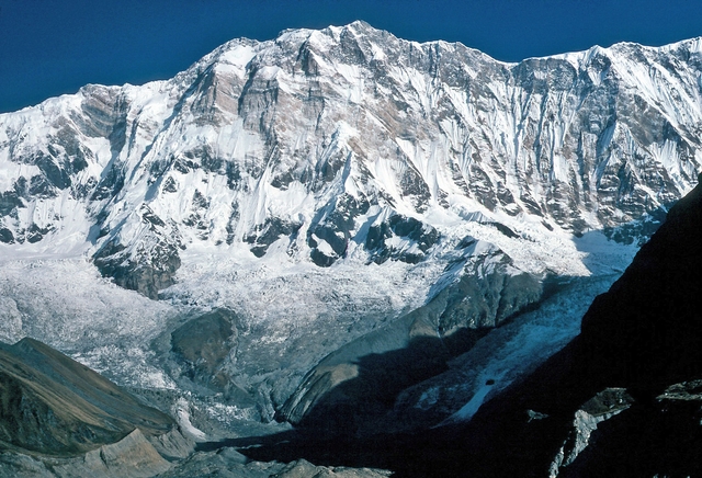
Kilimanjaro
Tanzania, East Africa
Oxygen Analysis — Oximeter
Oxygen comparison
Required Preparation
At 5895 m, with 47% oxygen available, perceived effort increases compared to sea level.
How to prepare
- Occasional training: this altitude requires mountaineering experience and specific preparation.
- Regular training: plan multiple days of progressive acclimatization at intermediate altitudes.
- Endurance training: physical fitness alone does not replace acclimatization at these altitudes.
- Consult a mountain medicine specialist before departure.
Route and Trail
Peak Guide
The roof of Africa. A dormant volcano rising from the Tanzanian savanna to 5895 meters with a majesty unmatched on the continent — a solitary mountain, part of no range, visible from hundreds of kilometers away with its cap of glaciers shrinking year after year. Kilimanjaro is the highest peak in Africa, a UNESCO World Heritage Site since 1987, and one of the Seven Summits. Reaching Uhuru Peak — "freedom" in Swahili — via the Machame Route means crossing five ecosystems in six days: from tropical rainforest to heathland, from alpine desert to summit glacier, until a crater where the air delivers a mere 47% of the oxygen available at sea level.
Quick Facts
| Detail | Value |
|---|---|
| Altitude | 5895 m a.s.l. (Uhuru Peak) |
| Massif | Kilimanjaro, shield volcano with three cones: Kibo (5895 m), Mawenzi (5149 m), Shira (3962 m) |
| Names | Kilimanjaro (IT/EN), Kilimandjaro (FR), Kilimandscharo (DE) |
| Difficulty | EE — High-altitude trekking, no technical climbing |
| Total elevation gain | ~4095 m from Machame Gate (1800 m) |
| Total distance | 62 km round-trip (Machame Route) |
| Duration | 6–7 days |
| Recommended season | January – March (short dry), June – October (long dry) |
| Starting point | Machame Gate (1800 m) |
| High base camp | Barafu Camp (4673 m) |
Oxygenation and Acclimatization
At 5895 meters barometric pressure grants a mere 47% of the oxygen available at sea level. Kilimanjaro places the trekker in the extreme altitude zone — where hypoxia is severe, Acute Mountain Sickness is the rule rather than the exception, and the risk of High Altitude Pulmonary Edema (HAPE) and High Altitude Cerebral Edema (HACE) becomes real without adequate acclimatization.
Typical summit SpO₂ ranges between 55 and 70% for subjects acclimatized during the week of ascent. These are values that cause mental confusion, extreme breathlessness with every step, and a fatigue that makes the final 300 meters of elevation gain — from Stella Point (5756 m) to Uhuru Peak — an experience at the limits of human endurance for most trekkers.
The Machame Route exploits the "walk high, sleep low" principle: on day four, the ascent to Lava Tower (4630 m) followed by a descent to Barranco Camp (3950 m) is specifically designed to stimulate acclimatization. This altitude profile is the Machame's primary advantage over the Marangu Route and contributes to its higher success rate.
Adopt diaphragmatic breathing from 3500 meters onward: inhale through the nose for four seconds, exhale through the mouth for six. Above 4500 meters, use pressure breathing: exhale forcefully against pursed lips to maintain alveolar pressure. Drink at least 3–4 liters of water per day. If you experience intense headache unresponsive to hydration, persistent nausea, ataxia, or breathlessness at rest, descend immediately — on Kilimanjaro, rapid descent is always possible and always effective.
Note: This advice is informational and does not replace medical consultation. Consult a physician specializing in high-altitude medicine before attempting Kilimanjaro.
The Ascent (Machame Route — 6/7 days)
The Machame Route — nicknamed the "Whiskey Route" for its reputation as a tougher path compared to the "Coca-Cola Route" (Marangu) — is considered the most scenic route and one of the most effective for acclimatization. It traverses the southwest face of Kibo with an altitude profile that alternates strategic ascents and descents.
Day 1: Machame Gate → Machame Camp
1800 m → 3000 m | Elevation gain: +1200 m | Distance: ~11 km | Time: 5–7 hours
Starting from Machame Gate in tropical rainforest: a damp, muddy trail beneath a canopy of giant trees draped in moss and lichen. The climb is steady but never steep. The air is warm and humid, colobus monkeys watch from the branches. At Machame Camp you emerge from the forest into heathland — the first ecosystem transition.
Day 2: Machame Camp → Shira Camp
3000 m → 3840 m | Elevation gain: +840 m | Distance: ~5 km | Time: 4–6 hours
The vegetation transforms into tree heather and giant lobelia — surreal plants that seem to belong to another planet. The trail climbs through the moorland with increasingly expansive views over the plains below. At Shira Camp the Shira Plateau opens up, a volcanic plateau at nearly 4000 meters where sunset sets the sky ablaze above a lunar landscape.
Day 3: Shira Camp → Lava Tower → Barranco Camp
3840 m → 4630 m → 3950 m | Elevation gain: +790 m / −680 m | Distance: ~10 km | Time: 6–8 hours
The key day for acclimatization. You climb to the Lava Tower (4630 m) — a 90-meter-tall lava monolith marking the boundary of the alpine desert zone — then descend to Barranco Camp (3950 m). This descent of nearly 700 meters after reaching 4630 m is the heart of the "walk high, sleep low" strategy. Many trekkers experience their first altitude sickness symptoms at the Lava Tower: headache, nausea, extreme fatigue. The descent relieves them almost immediately.
Day 4: Barranco Camp → Karanga Camp
3950 m → 3995 m | Elevation gain: +300 m / −255 m | Distance: ~5 km | Time: 4–5 hours
A short but memorable day. You immediately face the Barranco Wall — a 250-meter rock face climbed using hands (easy scrambling, but exposed). It is the most scenic passage on the entire Machame Route, with vertiginous views over the valley below. After the wall, the trail undulates through valleys and ridges to Karanga Camp, the last water resupply point.
Day 5: Karanga Camp → Barafu Camp
3995 m → 4673 m | Elevation gain: +678 m | Distance: ~4 km | Time: 3–4 hours
You climb to the high base camp, Barafu Camp (4673 m), through a barren alpine desert devoid of vegetation. The air is dry, the sun burns, the wind cuts. You arrive in the early afternoon: rest, drink, eat early, and try to sleep a few hours before the midnight wake-up call for the final summit push.
Day 6: Summit Night — Barafu Camp → Uhuru Peak → Mweka Camp
4673 m → 5895 m → 3100 m | Elevation gain: +1222 m / −2795 m | Distance: ~17 km | Time: 12–16 hours
Departure between midnight and 1 a.m., into the African night under a sky of impossible stars. The temperature ranges from −10°C to −25°C. The trail is a steep scree slope climbed in surreal silence, broken only by footsteps and labored breathing. Pole pole — slowly, slowly — is the Chagga guides' mantra. Every step costs effort, every meter is a conquest.
After 5–7 hours you reach Stella Point (5756 m) on the crater rim: the first sunlight of dawn illuminates the Kibo glaciers and the panorama opens onto a world that seems unreal. From here, another 45–60 minutes along the crater rim to Uhuru Peak (5895 m) — the highest point in Africa, with the iconic sign and remnant glaciers gleaming in the morning light.
The descent is rapid and exhausting: down to Barafu Camp for a brief stop, then continuing to Mweka Camp (3100 m) through the alpine zone and moorland. The knees suffer, but the lungs are grateful for every meter of altitude lost.
Day 7: Mweka Camp → Mweka Gate
3100 m → 1640 m | Elevation loss: −1460 m | Distance: ~10 km | Time: 3–4 hours
Final descent through the rainforest to Mweka Gate, where summit certificates are awarded and you bid farewell to the porters and guides.
Physical Preparation
Kilimanjaro is not a technical mountain — no rope, crampons, or ice axe are needed on the Machame Route — but it is one of the mountains that causes the most acute mountain sickness worldwide, precisely because its accessibility attracts people who underestimate the impact of altitude. Preparation must focus on sustained aerobic endurance and the ability to withstand effort over multiple consecutive days.
| Starting level | Preparation time | Key Phases |
|---|---|---|
| Sedentary / Beginner | 4–6 months | Walks of 4–6 hours with increasing elevation gains (up to 1000 m+). Multi-day mountain treks (2–3 days) with a backpack. Aerobic activity 3–4 times per week. |
| Regular Hiker | 2–3 months | 3–5 consecutive day treks with 800 m+ elevation gain per day. At least one experience above 3000 m to assess your personal altitude response. |
| Alpinist with high-altitude experience | 3–4 weeks | Maintaining aerobic fitness. Trekking with a heavy pack on uneven terrain for 6–8 hours. |
Equipment
Kilimanjaro crosses five climate zones: from tropical forest at 1800 m to glacier at nearly 6000 m. Equipment must handle conditions ranging from +25°C to −25°C over six days.
Essential:
- Waterproof, broken-in hiking boots — blisters are the first enemy
- Layering system: technical base layer, mid-layer fleece, waterproof Gore-Tex shell
- Heavy down jacket for summit night (comfort rating −15°C / −20°C)
- Double-layer gloves and beanie/balaclava for summit night
- Headlamp with spare batteries (summit night lasts 6–7 hours in darkness)
- Trekking poles — essential on descents
- Day pack 30–40 liters (porters carry the rest)
- At least 3 liters of water capacity — with purification tablets
- SPF 50+ sunscreen and sunglasses — equatorial exposure is intense
Recommended:
- Waterproof gaiters — rain and mud in the first days
- Hydration bladder (CamelBak-style) — for continuous drinking without stopping
- Pocket pulse oximeter to monitor your SpO₂
- Altitude sickness medication (Acetazolamide/Diamox) — discuss with your doctor before departure
- Extra energy snacks — appetite plummets at altitude
Historical Notes and Curiosities
Kilimanjaro is one of the most iconic mountains on the planet, immortalized in literature — Ernest Hemingway wrote "The Snows of Kilimanjaro" in 1936 — and by its unmistakable silhouette rising above the Serengeti and Amboseli plains. The name itself is shrouded in mystery: it may derive from the Swahili kilima njaro ("shining mountain") or from the Chagga word kilemanjaare ("impossible to conquer").
The first ascent: The summit was reached on October 6, 1889 by German geologist Hans Meyer and Austrian mountaineer Ludwig Purtscheller, accompanied by local guide Yohani Kinyala Lauwo of the Chagga people. Meyer had failed two previous attempts, stopped by altitude and glaciers. The third attempt succeeded: they cut a path through the ice with an axe and reached the highest point of the Kibo crater, which Meyer named Kaiser-Wilhelm-Spitze. After Tanzania's independence in 1961, the summit was renamed Uhuru Peak — "freedom peak."
Key milestones:
- 1889 — First ascent by Hans Meyer and Ludwig Purtscheller with guide Yohani Kinyala Lauwo
- 1912 — First complete traverse of the summit crater
- 1961 — Summit renamed Uhuru Peak upon Tanzania's independence
- 1973 — Kilimanjaro National Park established
- 1987 — National Park designated a UNESCO World Heritage Site
Curiosities:
- Kilimanjaro is the tallest freestanding mountain in the world — it belongs to no mountain range, rising in isolation from the plain
- The summit glaciers are retreating dramatically: they have lost over 80% of their surface area since 1912 and may disappear entirely by 2040–2050
- Approximately 35,000 people attempt the climb each year, with success rates varying from 45% (Marangu, 5 days) to 73% (Machame, 7 days) — acclimatization makes the difference
- The Chagga people have lived on Kilimanjaro's slopes for centuries and consider it sacred: the mountain is the dwelling place of ancestral spirits
- Kilimanjaro lies just 330 km south of the Equator, yet its summit is permanently covered in snow and ice
- The ascent passes through five distinct ecosystems: rainforest, heathland, moorland, alpine desert, and arctic glacial zone — a journey from the Equator to the Pole in one week of walking
⚠️ Medical disclaimer: The information provided is indicative and based on general physiological data. It does not replace the advice of a physician specializing in high-altitude medicine. Consult a professional before attempting Kilimanjaro.
Sources and References
The information on this page has been verified from the following sources
Related peaks
Discover other peaks in the same area