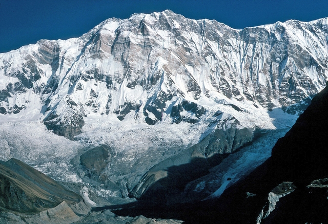
Mount Elbrus
Kabardino-Balkaria, Caucasus, Russia
Oxygen Analysis — Oximeter
Oxygen comparison
Required Preparation
At 5642 m, with 49% oxygen available, perceived effort increases compared to sea level.
How to prepare
- Occasional training: this altitude requires mountaineering experience and specific preparation.
- Regular training: plan multiple days of progressive acclimatization at intermediate altitudes.
- Endurance training: physical fitness alone does not replace acclimatization at these altitudes.
- Consult a mountain medicine specialist before departure.
Route and Trail
Peak Guide
The roof of Europe. A dormant volcano towering over the Caucasus range with its twin snow-covered summits, visible from hundreds of kilometers away — a colossal mountain, isolated in its majesty, separating the Russian steppes from the Georgian valleys. Mount Elbrus is Europe's highest peak at 5642 meters (west summit), one of the Seven Summits, and Russia's tallest mountain. Reaching the west summit via the normal route from the south side (from Azau) means traversing a landscape that shifts from the green Baksan Valley to the perennial glaciers of the Caucasus, arriving at a summit plateau where the air delivers a mere 49% of the oxygen available at sea level.
Quick Facts
| Detail | Value |
|---|---|
| Altitude | 5642 m a.s.l. (West Summit) |
| Massif | Greater Caucasus, dormant volcano with two summits: West (5642 m) and East (5621 m) |
| Names | Elbrus (IT/EN/FR), Эльбрус (RU), Минги-Тау (Karachay), Oshkhamakho (Circassian) |
| Difficulty | PD — Glacier mountaineering, crampons and ice axe required |
| Elevation gain from Garabashi | ~1795 m from Garabashi camp (3847 m) |
| Total distance | ~20 km round-trip from Garabashi |
| Summit push duration | 8–12 hours (ascent 6–8 h, descent 2–4 h) |
| Recommended season | June – September |
| Starting point | Azau (2350 m), cable car access to Mir (3500 m) |
| High base camp | Garabashi / Barrel Huts (3847 m) |
Oxygenation and Acclimatization
At 5642 meters barometric pressure grants a mere 49% of the oxygen available at sea level. Elbrus places the mountaineer in the extreme altitude zone — where hypoxia is severe, Acute Mountain Sickness (AMS) is very common, and the risk of High Altitude Pulmonary Edema (HAPE) and High Altitude Cerebral Edema (HACE) becomes real without adequate acclimatization.
Typical summit SpO₂ ranges between 58 and 72% for subjects acclimatized during the approach week. These are values that cause marked breathlessness, extreme fatigue, and cognitive slowing — the final 200 meters of elevation gain from the Saddle (5416 m) to the summit can take over an hour for many climbers.
Acclimatization on Elbrus follows the "climb high, sleep low" principle: in the days before the summit attempt, progressively higher outings are made — up to Pastukhov Rocks (4700 m) and beyond — always returning to sleep at Garabashi (3847 m). A minimum of 3–5 acclimatization days is recommended before the summit push.
Adopt diaphragmatic breathing from 3500 meters onward: inhale through the nose for four seconds, exhale through the mouth for six. Above 4500 meters, use pressure breathing: exhale forcefully against pursed lips to maintain alveolar pressure. Drink at least 3–4 liters of water per day. If you experience intense headache unresponsive to hydration, persistent nausea, ataxia, or breathlessness at rest, descend immediately — on Elbrus the descent from the south side is always possible along the ascent route.
Note: This advice is informational and does not replace medical consultation. Consult a physician specializing in high-altitude medicine before attempting Elbrus.
The Ascent (Normal Route — South Side)
The normal route from the south side is Elbrus's most popular and logistically accessible route. It starts from the Azau cable car station (2350 m) and ascends the volcano's southern face through glaciers and snow slopes with moderate but constant gradient.
Approach: Azau → Garabashi (Barrel Huts)
2350 m → 3847 m | Elevation gain: +1497 m (by cable car) | Time: ~30 minutes by cable car
From Azau, the cable car rises to Mir Station (3500 m), then a chairlift or short walk leads to the Garabashi Barrel Huts (3847 m) — Elbrus's classic base camp. Here you'll find the distinctive barrel-shaped shelters, the Diesel Hut (4050 m), and other support structures. Acclimatization days are spent making daily excursions to progressively higher altitudes.
Acclimatization: Ascents to Pastukhov Rocks
3847 m → 4700 m → 3847 m | Elevation gain: +853 m / −853 m | Time: 4–6 hours round-trip
Pastukhov Rocks (4700 m) are the key acclimatization landmark. They are reached by ascending the glacier with crampons and ice axe on 20–25° slopes. From here, the view spans the Saddle and both summits. Typically 2–3 progressive ascents are made on successive days, gradually raising the altitude reached.
Summit Day: Garabashi → West Summit
3847 m → 5642 m → 3847 m | Elevation gain: +1795 m / −1795 m | Distance: ~20 km round-trip | Time: 8–12 hours
Departure between 1 and 3 a.m. from Garabashi, in darkness and intense cold (−15°C to −30°C depending on the season). Ratrak (snow cats) transport some climbers to Pastukhov Rocks (4700 m), reducing the elevation gain — but climbing on foot from the start provides a more rewarding mountaineering experience.
From Pastukhov Rocks, the route continues on open glacier with 25–30° slopes to the diagonal traverse leading to the Saddle (5416 m) — the col between the two summits. This section, approximately 1 km long, is the most wind-exposed and psychologically demanding. From the Saddle, the final push to the West Summit (5642 m) climbs approximately 200 meters of elevation on 30–35° slopes — an hour or more of extreme effort in thin air.
At the summit, a small snow plateau offers views stretching from the Black Sea to the Caspian Sea, from Ararat to the Russian steppes. Time at the top is brief: cold, wind, and hypoxia demand a rapid descent along the same ascent route.
Physical Preparation
Elbrus is not a technically difficult mountain — the normal route presents no significant rock passages or crevasses on the classic path — but the combination of high altitude, extreme cold, and the length of summit day makes it a serious challenge. Many aspirants underestimate Elbrus because "it's just walking on snow," yet the success rate of commercial expeditions hovers around 50–60%, primarily due to altitude sickness and bad weather.
| Starting level | Preparation time | Key Phases |
|---|---|---|
| Sedentary / Beginner | Not recommended without prior experience above 4000 m | First gain mountaineering experience at 4000 m (Mont Blanc, Monte Rosa). Take crampon and ice axe courses. |
| Regular Hiker | 3–6 months | Glacier ascents with crampons (Breithorn, Gran Paradiso). 3+ day treks with 1000 m+/day elevation gain. Intense aerobic activity 3–4 times per week. |
| Mountaineer with high-altitude experience | 4–6 weeks | Maintaining aerobic fitness. Glacier training. Experience above 4500 m recommended. |
Equipment
Elbrus is a glacial mountain with arctic conditions at the summit. Equipment must handle temperatures that can drop below −30°C with strong winds, on entirely icy terrain above 4000 m.
Essential:
- High-mountain boots (double or insulated, compatible with semi-automatic/automatic crampons)
- Semi-automatic or automatic crampons
- Classic ice axe (50–60 cm)
- Glacier harness and crevasse rescue kit (rope, carabiners, slings)
- Layering system for −30°C: technical base layer, heavy fleece, thick down jacket, windproof Gore-Tex shell
- Double-layer gloves (liner gloves + expedition mittens)
- Balaclava and glacier goggles (cat. 4)
- Headlamp with lithium batteries (cold rapidly drains alkaline batteries)
- Trekking poles
- SPF 50+ sunscreen (snow reflection is intense)
- Thermos with hot drink for summit day
Recommended:
- Windproof face mask for the Saddle traverse
- Pocket pulse oximeter to monitor your SpO₂
- Altitude sickness medication (Acetazolamide/Diamox) — discuss with your doctor
- Chemical hand and toe warmers
- Two-way radio (in case of group separation in fog)
Logistics and Permits
Elbrus is located in the Kabardino-Balkarian Republic, a region of the Russian Caucasus. Access requires:
- Russian visa (required for most European citizens)
- Border zone permit: the Elbrus area is a border zone with Georgia and requires a special permit, obtainable through the organizing agency or directly from Russian authorities with at least 60 days' advance notice
- Elbrus National Park registration and entry fee payment
Most climbers rely on local agencies that manage logistics, permits, guides, and ratrak transportation.
Historical Notes and Curiosities
Elbrus is one of the world's most legendary mountains, steeped in Caucasian mythology — according to tradition, it was on the summit of Elbrus (or a Caucasian mountain) that Zeus chained Prometheus for stealing fire from the gods. The name "Elbrus" may derive from the Iranian Alborz ("high mountain") or from the Turkic El-borus ("he who directs the winds").
The first ascent: The east summit (5621 m) was reached on July 22, 1829 by Killar Khashirov, a Kabardian guide, during a Russian military expedition led by General Georgi Emmanuel. The west summit (5642 m), the true peak, was reached on July 28, 1874 by British mountaineers Florence Crauford Grove, Frederick Gardner, Horace Walker, and Swiss guide Peter Knubel.
Key milestones:
- 1829 — First ascent of the east summit (5621 m) by Killar Khashirov
- 1874 — First ascent of the west summit (5642 m) by Grove, Gardner, Walker, and Knubel
- 1956 — 400 Soviet mountaineers summit simultaneously to celebrate the 400th anniversary of Kabardino-Balkaria
- 1997 — A Land Rover Defender reaches the east summit — the altitude record for a wheeled vehicle in Europe
- 2007 — Inauguration of the new tri-cable gondola to Mir (3500 m)
Curiosities:
- Elbrus is Europe's highest mountain — if the Caucasus is considered the boundary between Europe and Asia, as per the most widely accepted geographical convention
- It is a dormant volcano: the last eruption occurred approximately 2000 years ago, but fumarolic activity has been detected on the east summit
- The weather is extremely changeable: sudden snowstorms with winds exceeding 100 km/h can strike even in midsummer, making the Saddle traverse extremely dangerous
- Elbrus has a tragic history of accidents: rapidly changing weather and underestimation of the mountain cause numerous fatalities every year
- The twin summits are connected by a saddle at 5416 m: from the Saddle, the west summit is reached in about 1 hour, the east summit in about 40 minutes
- The Barrel Huts at Garabashi have become an icon of Russian mountaineering: small colorful metal cylinders clinging to the glacier at 3847 m
⚠️ Medical disclaimer: The information provided is indicative and based on general physiological data. It does not replace the advice of a physician specializing in high-altitude medicine. Consult a professional before attempting Elbrus.
Sources and References
The information on this page has been verified from the following sources
Related peaks
Discover other peaks in the same area