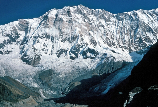
Monte Vettore
Monti Sibillini, Marche/Umbria, Italy
Oxygen Analysis — Oximeter
Oxygen comparison
Required Preparation
At 2476 m, with 74% oxygen available, perceived effort increases compared to sea level.
How to prepare
- Occasional training: plan gradual acclimatization — resting heart rate will rise at this altitude.
- Regular training: keep a steady pace and watch for mild hypoxia symptoms.
- Endurance training: altitude is manageable with planning — avoid forcing the pace in the first hours.
Route and Trail
Peak Guide
The roof of the Sibillini. At 2476 metres, Monte Vettore is the highest summit in the entire massif — a borderland peak straddling Marche and Umbria inside the Monti Sibillini National Park. On clear days the summit panorama spans from the Gran Sasso to the south, the Adriatic coast to the east, and the Castelluccio plateau spreading below to the west. Below the summit lies the Lago di Pilato, a glacial lake steeped in medieval legend. At this altitude you're breathing 74% of the oxygen available at sea level — a reduction you'll notice on the steeper stretches, but nothing that'll stop a fit hiker.
Quick Facts
| Detail | Value |
|---|---|
| Altitude | 2476 m a.s.l. |
| Mountain group | Monti Sibillini, Umbro-Marchigiano Apennines |
| Park | Parco Nazionale dei Monti Sibillini |
| Difficulty | E (Hikers) |
| Elevation gain | 1026 m |
| Total distance | 11 km return |
| Ascent time | ~3h from Forca di Presta |
| Total time | ~4h 40min (ascent + descent) |
| Starting point | Forca di Presta, Arquata del Tronto (1540 m) |
| Mountain hut | Rifugio Tito Zilioli (2240 m) |
| Trail | E15 (CAI) |
| Best season | June – October |
The Route
Start at Forca di Presta (1540 m), a road pass between Arquata del Tronto and Castelluccio di Norcia, reachable by car. The Parco Nazionale information boards mark the trailhead for the E15 — a well-signed path, hard to lose. The climb starts immediately and doesn't really let up.
The trail ascends diagonally north-east, with views opening over the Tronto valley almost from the first switchback. You'll cross the shoulder of Monte Vettoretto (2052 m) — not a detour, it's on the normal route — roughly 1.5 hours in. Then a final steeper section leads up to Rifugio Tito Zilioli (2240 m), rebuilt after the 2016 earthquake. Stop here. The view of the Lago di Pilato basin is worth the pause.
From the ridge above the hut you push west. The ground turns rockier, the switchbacks multiply. The final stretch climbs over limestone scree: no technical moves required, but sure feet and attention matter. You'll pass a first summit cross — that's not the top — and continue to the true summit of Monte Vettore (2476 m). The 360° panorama is one of the finest in the central Apennines: virtually every Sibillini peak visible, the Lago di Pilato far below, the Corno Grande on the distant southern horizon.
Descent follows the same route. Plan 1h 40min back down.
Oxygen and Acclimatisation
At 2476 metres you're just below the 2500 m threshold where altitude medicine texts start taking AMS seriously. You're working with 74% of sea-level oxygen — that means your breathing rate goes up, your heart rate climbs faster than usual, and you'll feel fatigue setting in sooner. At the summit, a healthy hiker's SpO₂ typically reads between 93 and 96%. Entirely manageable.
AMS risk at this altitude is low. No advance acclimatisation needed. That said: if you're coming up from the coast in one shot, keep your pace honest from the start. Drink before you're thirsty. At altitude, thirst lags behind dehydration by about 15 minutes.
On the steeper limestone sections, use diaphragmatic breathing: four seconds in through the nose, six seconds out through the mouth. Ten-second breaks every few minutes are more efficient than powering through and bonking.
These notes are informational and don't replace medical advice.
Preparation
Essential gear:
- High-ankle hiking boots with a stiff sole — limestone scree and loose rock punish trail shoes
- At least 1.5 litres of water — no reliable water sources between Forca di Presta and Rifugio Zilioli
- Windproof and waterproof jacket — Sibillini weather turns fast, even in July
- Trekking poles — your knees will thank you on the 1000 m descent
Recommended:
- Sunglasses and SPF 50+ sunscreen — the summit ridge is fully exposed
- An insulating mid-layer — the summit is reliably windy even in summer
- A pocket pulse oximeter — useful if you want to track your SpO₂ during the climb
When to go: June through October, peak conditions July to September. In spring the trail above 2000 m can carry snow. Winter ascents are classified EAI and require crampons and ice axe. Summer weekends are busy — start at dawn if you want the summit to yourself.
Honest difficulty assessment: E (Hikers) is the grade, but 1026 metres of elevation gain is a real commitment for anyone not used to mountain walking. There's no exposed scrambling or technical ground. The challenge is sustained gradient and duration. Regular mountain walkers won't have a problem. Couch-to-summit attempts are a different story.
Frequently Asked Questions
How much oxygen is available at the summit of Monte Vettore?
At Monte Vettore's summit (2476 m), the available oxygen is 74% of sea-level concentration, calculated using the ICAO Standard Atmosphere formula. You'll notice the difference on steep sections — breathing rate and heart rate both increase more than usual — but this poses no risk to fit, healthy hikers. Typical blood oxygen saturation (SpO₂) at the summit sits between 93 and 96%.
Is altitude sickness a risk on Monte Vettore?
The risk is low. The clinically relevant AMS threshold is generally placed around 2500 m; Monte Vettore sits just below that line. No advance acclimatisation is needed for a day hike. If you experience persistent headache, nausea, or dizziness that doesn't improve with rest, descend — it's the most effective treatment at any altitude.
What's the best time of year to climb Monte Vettore?
June through October, with optimal conditions in July and August. Spring snow can linger above 2000 m into June. Winter turns the route into a serious mountaineering undertaking requiring crampons and ice axe (EAI grade). July and August weekends are popular — an early start avoids the crowds and typically gives the clearest views before afternoon clouds build.
Do I need to book the Rifugio Zilioli?
The Rifugio Tito Zilioli (2240 m) was rebuilt after the 2016 earthquake. For current opening dates, bed availability and booking, check directly with the Parco Nazionale dei Monti Sibillini or the CAI. For a day hike from Forca di Presta, the rifugio is a mid-route rest stop — you don't need to overnight there.
Sources and References
The information on this page has been verified from the following sources
Related peaks
Discover other peaks in the same area