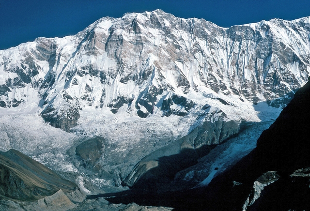
Mount Rainier
Cascade Range, Washington, USA
Oxygen Analysis — Oximeter
Oxygen comparison
Required Preparation
At 4392 m, with 58% oxygen available, perceived effort increases compared to sea level.
How to prepare
- Occasional training: specific preparation and progressive acclimatization are required before the summit.
- Regular training: plan acclimatization stops and monitor oxygen saturation.
- Endurance training: respect physiological adaptation times even if fitness level is high.
- Consider a sports medical assessment before the ascent.
Route and Trail
Peak Guide
The giant of the Pacific Northwest. Mount Rainier rises to 4392 meters above sea level as an active stratovolcano draped in permanent glaciers, dominating the skyline of Washington State and visible from Seattle on every clear day — an imposing presence that the Puyallup people called Tahoma, "mother of waters." It is not the highest peak on the continent, but it is one of the most massive glaciated volcanoes in the United States, with 26 glaciers covering more than 90 square kilometers and draining water into three separate river systems. Climbing via the Disappointment Cleaver — the most popular standard route — means tackling the true school of North American glacier mountaineering: deep crevasses, hard snow, the risk of serac falls, and an atmosphere that at 4392 m delivers only 58% of the oxygen available at sea level.
Quick Facts
| Detail | Value |
|---|---|
| Altitude | 4392 m a.s.l. (Columbia Crest) |
| Type | Active stratovolcano, Cascade Range |
| Difficulty | PD/AD — Glacier mountaineering, crampons, ice axe and rope mandatory |
| Total elevation gain | ~2738 m from Paradise (1654 m) |
| Total distance | ~16 km round-trip (Disappointment Cleaver) |
| Duration | 2 days (with overnight at Camp Muir, 3077 m) |
| Recommended season | May – September |
| Starting point | Paradise (1654 m) — accessible by car |
| High base camp | Camp Muir (3077 m) |
| Permit required | Yes — NPS climbing permit ($46/person in 2024) |
Oxygenation and Acclimatization
At 4392 meters, barometric pressure provides only 58% of the oxygen available at sea level. Mount Rainier is a mountain that many underestimate: it is not Everest, not Denali, yet it causes numerous cases of Acute Mountain Sickness every season among climbers who attempt the summit too quickly or without adequate preparation. The ascent from Paradise (1654 m) to Columbia Crest (4392 m) takes fewer than 24 hours of active effort — a rate of altitude gain that permits no significant acclimatization.
Typical summit SpO₂ ranges between 70 and 80% for healthy, aerobically fit individuals. These values can cause headache, significant breathlessness during exertion, reduced mental clarity, and in susceptible individuals, genuine AMS (Acute Mountain Sickness) episodes.
HAPE (High Altitude Pulmonary Edema) is a serious and documented risk on Rainier. At 4392 m — precisely the altitude range (3000–4500 m) where HAPE most commonly occurs according to the Wilderness Medical Society — the mountain records HAPE cases every season, including fatal ones. Rapid ascent from Paradise (1654 m) to the summit in a single push without an acclimatization night at Camp Muir significantly increases risk. Warning signs include severe breathlessness at rest, a persistent dry or wet cough, crackling breath sounds, and extreme fatigue. If these symptoms develop, descend immediately — do not wait for morning. For a complete guide to recognizing and managing HAPE in the field, read HACE and HAPE: High Altitude Edema Symptoms & Treatment.
Ideal acclimatization includes at least one night at Camp Muir (3077 m) — the high glacier camp — before the summit push. Those who ascend from Paradise and reach Columbia Crest the same day without an overnight stop face a higher risk of altitude symptoms. Practical recommendation: sleep at Muir on the first evening, depart for the summit between 2–4 a.m., and carefully observe how your body responds above 3500 m.
Maintain a steady pace and drink continuously: dehydration accelerates altitude sickness symptoms. If severe headache, persistent nausea, or loss of balance develops, descend immediately — Camp Muir is only 2–3 hours below the summit, and Paradise is reachable from there in under an hour.
Before your climb: use the Oxymeter altitude oxygen calculator to calculate the exact oxygen availability and your estimated SpO₂ at Camp Muir (3077 m) and Columbia Crest (4392 m) — so you know what to expect before leaving the Paradise trailhead.
Note: This advice is informational and does not replace medical consultation. Consult a physician specializing in high-altitude medicine before attempting Mount Rainier.
The Ascent (Disappointment Cleaver — 2 days)
The Disappointment Cleaver is Rainier's most frequently used standard route, followed by approximately 60% of summit-bound climbers. Its name reflects the disappointment of early climbers who mistook it for a faster passage — yet it remains the safest way to navigate around the crevasses of the Ingraham Glacier.
Day 1: Paradise → Camp Muir
1654 m → 3077 m | Elevation gain: +1423 m | Distance: ~8 km | Time: 5–7 hours
The route departs from the Paradise Visitor Center, initially crossing well-marked trails through alpine meadows brilliant with wildflowers in summer. Above the snowline — typically around 2000 m — crampons go on and the ice axe comes out. Pebble Creek (2400 m) is the mid-route landmark; from here the terrain becomes a steep snowfield ascending toward Pan Point (2900 m) and then Camp Muir (3077 m), a rock bivouac hut with breathtaking views across Mount Adams, Mount Hood, and on clear days, Mount Saint Helens.
Camp Muir has an NPS public shelter (30 bunks, advance reservation essential), an RMI guides' hut, and sanitation facilities. Eat early, hydrate thoroughly, and try to sleep a few hours before the pre-dawn alarm.
Day 2: Camp Muir → Columbia Crest → Paradise
3077 m → 4392 m → 1654 m | Elevation gain: +1315 m / elevation loss: −2738 m | Total time: 12–16 hours
Departure between 2 and 4 a.m. — the snow is firmer and safer in cold hours, and the risk of serac release from the Ingraham Glacier is reduced. Cross the Cowlitz Glacier to the base of the Disappointment Cleaver, a rocky spur at approximately 3500 m separating the Cowlitz and Ingraham glaciers. The climb up the Cleaver involves mixed hands-and-feet movement on crumbly rock and ice — the most technical section of the route.
Above the Cleaver, the route enters the upper Ingraham Glacier: heavily crevassed terrain where roped travel is mandatory. A misstep in this section can result in a crevasse fall. The seracs of the Corridor (4000–4200 m) are massive and require swift passage during cold hours.
Above the Crater Rim (4330 m) the route traverses the edge of Rainier's summit volcanic crater — one of the few active volcanoes in the world where hikers walk across the summit. Columbia Crest (4392 m) is the highest point: a small snow and ice dome. Descent follows the same route in reverse, with a rest stop at Camp Muir before returning to Paradise.
Physical Preparation
Mount Rainier is the preferred training mountain for North American climbers preparing for Himalayan expeditions. It is physically demanding but does not require extreme technical skill levels.
| Starting level | Preparation time | Key Phases |
|---|---|---|
| Experienced hiker | 3–6 months | Outings with a heavy pack (15–20 kg) over 1200+ m of elevation gain; nighttime hikes; at least one crampon outing on snow. A basic glacier mountaineering course is strongly recommended. |
| Alpinist with glacier basics | 1–2 months | Maintain fitness; sustained-pace outings for 8+ consecutive hours; verify glacier equipment. |
| Beginner without snow experience | 6–9 months | Attend a basic mountaineering course; progressive trekking; Rainier is not suitable as a first glacier experience. |
Equipment
Rainier demands full glacier mountaineering gear. This is not a hike in trail runners — hard snow and live ice are present from Camp Muir to the summit.
Essential:
- 12-point crampons compatible with stiff mountaineering boots
- Technical ice axe for snow and glacier travel
- Harness, rope (typically teams of 3–4), carabiners, prusik cords
- Stiff plastic or leather mountaineering boots with Vibram sole
- Layered clothing: technical base layer, fleece, waterproof Gore-Tex shell
- Down jacket or heavy insulating layer for Camp Muir (overnight temperatures −10 to −15°C)
- Heavy mountaineering gloves with spares
- Glacier goggles with full UV protection — snow reflection is intense
- Headlamp with spare batteries for the pre-dawn departure
- Trekking poles (useful to Camp Muir, then stow on pack above)
- SPF 50+ total-body sunscreen (including lips and neck)
- At least 3–4 liters of water plus purification
Recommended:
- Tall waterproof gaiters — snow enters boots without them
- Sleeping bag (−10°C comfort) for Camp Muir
- Pocket pulse oximeter to monitor SpO₂ above 3000 m
- Medications: Ibuprofen for altitude headache; Acetazolamide (Diamox) — discuss with your doctor
Historical Notes and Curiosities
Mount Rainier is the highest peak in the Cascade Range within the contiguous United States and one of 16 "Decade Volcanoes" identified by the IAVCEI program as deserving priority study due to high volcanic risk. It is not "merely" a summit: it is a hydrological system feeding 5 rivers of Washington State and a source of fresh water for millions of people.
The first ascent: Columbia Crest was first reached on record on August 17, 1870 by Hazard Stevens and Philemon Beecher Van Trump, accompanied by Yakama guide Sluiskin, who led them to the mountain's base but refused to climb further — convinced the summit was the dwelling place of spirits. Stevens and Van Trump bivouacked inside the summit crater, surviving the night thanks to volcanic steam rising through fumaroles.
Key milestones:
- 1870 — First confirmed ascent by Stevens and Van Trump
- 1884 — First female ascent by Fay Fuller, the first woman on the summit
- 1899 — Mount Rainier National Park established (third national park in the USA)
- 1936 — Rainier Mountaineering Inc. (RMI) founded, still the primary guiding agency today
- 2014 — The Disappointment Cleaver is officially recognized as the standard route after decades of use
Curiosities:
- Rainier is the US volcano with the highest lahar risk: in the event of an eruption, lahars (volcanic mudflows) could reach the Tacoma metropolitan area (300,000 residents) in under 2 hours
- The Emmons Glacier on the east flank is the most extensive glacier in the contiguous 48 states (approximately 11 km²)
- Approximately 10,000–13,000 climbers attempt the summit each year, with a success rate of 50–55% — spring weather is the primary limiting factor
- The Paradise Visitor Center holds the record for the greatest measured snowfall accumulation at its elevation anywhere in the world — 28.5 m in winter 1971–72
- Rainier ascents are used as acclimatization tests by Himalayan expeditions: if you struggle with the altitude on Rainier, recalibrate your preparation before attempting higher peaks
Frequently Asked Questions
How much oxygen is available at the top of Mount Rainier?
At Columbia Crest (4392 m), barometric pressure provides approximately 58% of the oxygen available at sea level. This is the same oxygen fraction as Mount Whitney, but the physical demands of glacier travel — crampons, rope, heavy pack, and a pre-dawn start — make the physiological load significantly higher. Use the Oxymeter altitude oxygen calculator to calculate exact oxygen partial pressure at each camp: Paradise (1654 m), Camp Muir (3077 m), and the summit (4392 m).
What SpO₂ should I expect while climbing Mount Rainier?
At Camp Muir (3077 m), most climbers see SpO₂ in the 82–90% range. At the summit (4392 m), values typically drop to 70–80% in well-acclimatized individuals. Monitor your oxygen saturation throughout the climb with a pocket pulse oximeter — a rapid drop or a reading below 70% at altitude is a clear signal to assess your condition. See Best Pulse Oximeter for Hiking & High Altitude for equipment recommendations.
Is HAPE a serious risk on Mount Rainier?
Yes — more than many climbers assume. Rainier sits squarely in the altitude band (3000–4500 m) where HAPE most frequently develops. The mountain records documented HAPE cases every season. The main risk factor is fast ascent: going from Paradise (1654 m) to 4392 m without an acclimatization night at Camp Muir compresses the ascent profile dangerously. Know the warning signs — severe breathlessness at rest, persistent cough, crackling breath sounds — and descend immediately if they appear. Full guide: HACE and HAPE: High Altitude Edema Symptoms & Treatment.
How difficult is the Disappointment Cleaver route on Mount Rainier?
The Disappointment Cleaver is rated PD/AD (Peu Difficile to Assez Difficile) in alpine grading — it requires crampons, ice axe, harness, rope, and the ability to move safely on glaciated terrain with live crevasses and serac exposure. It is not a hike. Prior glacier experience is strongly recommended; Rainier is itself commonly used as a preparatory ascent for Himalayan expeditions.
When is the best time to climb Mount Rainier?
The season runs from May to September, with May–July offering the most stable snow conditions for glacier travel. Summer thunderstorms become a factor from late July onward. Success rates average 50–55% across all attempts, with weather being the primary cause of turnaround.
⚠️ Medical disclaimer: The information provided is indicative and based on general physiological data. It does not replace the advice of a physician specializing in high-altitude medicine. Consult a professional before attempting Mount Rainier.
Sources and References
The information on this page has been verified from the following sources
Related peaks
Discover other peaks in the same area