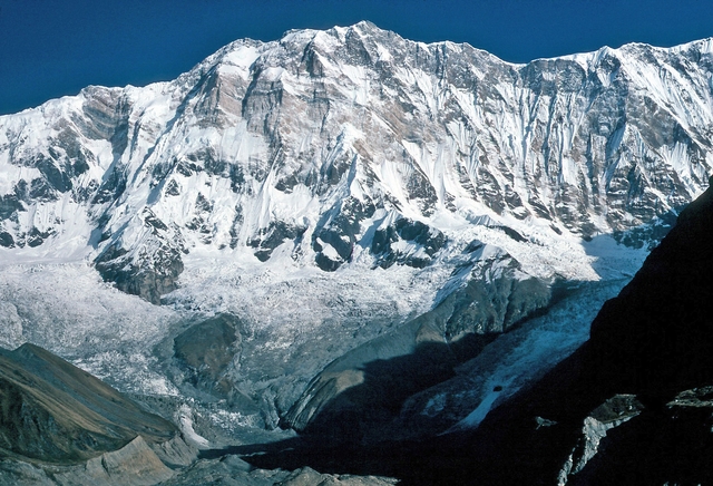
Mount Whitney
Sierra Nevada, California, USA
Oxygen Analysis — Oximeter
Oxygen comparison
Required Preparation
At 4421 m, with 58% oxygen available, perceived effort increases compared to sea level.
How to prepare
- Occasional training: specific preparation and progressive acclimatization are required before the summit.
- Regular training: plan acclimatization stops and monitor oxygen saturation.
- Endurance training: respect physiological adaptation times even if fitness level is high.
- Consider a sports medical assessment before the ascent.
Route and Trail
Peak Guide
The roof of the contiguous United States. Mount Whitney rises to 4421 meters above sea level in the California Sierra Nevada — the highest summit in the lower 48 states, separated from Death Valley (the lowest point in North America at −86 m) by just 130 kilometers as the crow flies. A geographical contrast unmatched anywhere on Earth: from the deepest depression to the highest peak in the contiguous USA in under two hours by car. Whitney is not a technical climb: no crampons, ice axe, or roped travel are required on the standard route. But the air at 4421 m delivers only 58% of the oxygen at sea level, and many hikers who tackle the 35-kilometer Whitney Trail — 1871 meters of elevation gain from Whitney Portal — underestimate how hard the human body works to function with so little oxygen.
Quick Facts
| Detail | Value |
|---|---|
| Altitude | 4421 m a.s.l. (main summit) |
| Massif | Sierra Nevada, California, USA |
| Difficulty | Class 1 — Strenuous hiking, no technical climbing |
| Total elevation gain | ~1871 m from Whitney Portal (2550 m) |
| Total distance | ~35.2 km round-trip (Mount Whitney Trail) |
| Duration | 1 day (fast hikers) – 2 days (with overnight at Trail Camp or Guitar Lake) |
| Recommended season | July – September |
| Starting point | Whitney Portal (2550 m) — drivable from Lone Pine |
| Intermediate camp | Trail Camp (3624 m) or Guitar Lake (3380 m) |
| Permit required | Yes — Whitney Zone Permit (annual lottery, limited availability) |
Oxygenation and Acclimatization
At 4421 meters, barometric pressure provides only 58% of the oxygen available at sea level. Mount Whitney is insidiously dangerous precisely because of its reputation as a "hard hike" rather than "mountaineering" — this leads many people to attempt it without adequate preparation or acclimatization, with consequences that every summer require search-and-rescue operations.
Typical summit SpO₂ ranges between 70 and 80% for healthy, fit individuals. These values commonly cause headache (the most frequent symptom on Whitney), breathlessness during the final 500 meters of elevation gain — the famous 99 switchbacks above 3600 m — nausea, and in some cases mental impairment. Acute Mountain Sickness affects a significant percentage of hikers, particularly those who arrive at the trailhead from near sea level (Los Angeles, 71 m; Las Vegas, 610 m) on the same day they start hiking.
Recommended strategy: sleep at least one night at 2100–2400 m before starting the trail. A night at Whitney Portal (2550 m) is the minimum. Ideally, one or two nights at progressively higher camps — Lone Pine Campground (1270 m), Whitney Portal Campground (2550 m), Trail Camp (3624 m) — builds a solid acclimatization profile.
Drink continuously throughout the ascent — dehydration at this altitude significantly accelerates altitude sickness symptoms. Eat frequently, even small amounts: hypoxia suppresses appetite but calories are needed to maintain muscular performance. If the three classic AMS symptoms appear (headache + nausea + disproportionate fatigue), descend to your previous altitude and wait for improvement before continuing.
HAPE (High Altitude Pulmonary Edema) is a less common but potentially fatal complication at 4421 m. It typically develops within the first 24–48 hours of rapid ascent from sea level — exactly the pattern most Whitney day-hikers follow. Warning signs include an insistent dry cough progressing to frothy or pink-tinged sputum, severe shortness of breath even at rest, and extreme fatigue disproportionate to exertion. If any of these appear, descend immediately and seek emergency assistance: HAPE is the leading cause of death from altitude illness worldwide. For a complete guide to recognizing and managing HAPE and HACE in the field, see HACE and HAPE: High Altitude Edema Symptoms & Treatment.
Before your hike: use the Oxymeter altitude oxygen calculator to predict your estimated SpO₂ at 4421 m and understand how much oxygen your body will have available at each stage of the Whitney Trail — from Whitney Portal to the summit.
Note: This advice is informational and does not replace medical consultation. Consult a physician specializing in high-altitude medicine before attempting Mount Whitney.
The Ascent (Mount Whitney Trail — 1–2 days)
The Mount Whitney Trail is one of the most heavily used trails in the United States, with a strict permit system limiting access during summer to protect the fragile Sierra Nevada ecosystem. The route is well-marked, well-trodden, and technically non-exposed — but it is not a stroll.
Section 1: Whitney Portal → Outpost Camp
2550 m → 3272 m | Elevation gain: +722 m | Distance: ~6 km | Time: 2–3 hours
Departure from Whitney Portal through a forest of Jeffrey and lodgepole pines — the scent of resin in the Sierra morning breeze is one of the most sensory delights of the hike. The trail climbs steadily through open woodland, crosses Lone Pine Creek several times on log bridges, and reaches the Lone Pine Lakes (2970 m) — small alpine lakes surrounded by white granite. Outpost Camp (3272 m) is the first viable overnight spot, with flat tent sites and running water from the stream.
Section 2: Outpost Camp → Trail Camp
3272 m → 3624 m | Elevation gain: +352 m | Distance: ~3 km | Time: 1–2 hours
The trail climbs beyond Mirror Lake (3360 m) — a glacial tarn with perfect reflections that in July is still partially frozen — and reaches Consultation Lake before the broad plateau of Trail Camp (3624 m), the preferred overnight spot for the majority of hikers opting for the two-day approach. From here, the view across the eastern Sierra Nevada granite peaks is breathtaking.
This is the altitude where the first hypoxia signals become apparent: heart rate noticeably accelerates, breathing becomes more frequent even at rest, and nighttime sleep is often disturbed. These are normal adaptation signals — your body is working. If the headache is severe and does not abate, descend.
Section 3: Trail Camp → 99 Switchbacks → Trail Crest
3624 m → 4115 m | Elevation gain: +491 m | Distance: ~3 km | Time: 2–3 hours
The famous 99 switchbacks (actually approximately 97, but the name has stuck) are the most iconic section of the Whitney Trail: a series of tight hairpin turns that climb steeply up the granite face from 3624 m to the Trail Crest (4115 m) — the pass on the Sierra Nevada crest that provides the first view of the western slope and, on clear days, of the entire Sequoia National Park. At these altitudes the air is thin and every switchback is felt. Snow persists in this section until July–August in average years: check current conditions before setting out.
Section 4: Trail Crest → Summit
4115 m → 4421 m | Elevation gain: +306 m | Distance: ~3 km | Time: 1–2 hours
From Trail Crest, the route traverses the Sierra Nevada summit ridge northward, with panoramas on both sides — east toward Owens Valley and Death Valley, west toward Kings Canyon. The terrain is granite boulders and slabs, with some sections requiring attention but no technical difficulty. At the summit, 4421 m, stands the famous Smithsonian Institution Hut — a small stone cabin built in 1909 now used as an emergency shelter — and the summit register where every visitor can leave their name.
Physical Preparation
Mount Whitney is a demanding high-altitude hike. It is not technical mountaineering, but it is not a casual walk. Preparation must focus on sustained aerobic endurance and the ability to manage long days with a loaded pack.
| Starting level | Preparation time | Key Phases |
|---|---|---|
| Regular hiker (weekend hiking) | 2–4 months | 6–8-hour hikes with a pack (10–15 kg) and 1000+ m of elevation gain; at least one overnight in a tent; verify personal altitude response above 3000 m. |
| Frequent hiker with mountain experience | 3–6 weeks | Maintain fitness; long outings at altitude; monitor SpO₂ with a pulse oximeter. |
| Sedentary beginner | 4–6 months | Progressively build from flat walks to strenuous hikes; develop basic aerobic fitness; do not underestimate altitude. |
Equipment
The Whitney Trail is technically accessible but requires appropriate gear for a high-altitude hike in a remote environment.
Essential:
- Waterproof, broken-in hiking boots with a stiff sole — 35 km of varied terrain demands solid footwear
- Layered clothing: technical base layer, fleece, waterproof shell (Sierra Nevada summer afternoon thunderstorms are fast and violent)
- Hat, gloves, and insulating layer even in summer — summit temperatures can drop below 0°C even in August
- At least 3–4 liters of water capacity; trail water sources are drinkable with a filter
- High-calorie food for 8–14 hours of activity
- Trekking poles — essential for the 99 switchbacks and the long descent
- Headlamp with spare batteries — those starting at 2–3 a.m. to avoid afternoon storms need them
- SPF 50+ sunscreen and sunglasses — UV intensity above 4000 m is extreme
- Camp shoes for overnight stops
Recommended:
- Lightweight crampons or microspikes — the switchbacks section can be icy until July–August
- Pocket pulse oximeter to monitor SpO₂
- Bear canister — mandatory for overnight stays in the Whitney Zone
- Medications: Ibuprofen, Acetazolamide (Diamox) — discuss with your doctor
Historical Notes and Curiosities
Mount Whitney is named after Josiah Whitney, geologist and Harvard professor who directed the first geological survey of California in the second half of the nineteenth century. Ironically, Whitney never climbed the mountain bearing his name — he was convinced, incorrectly, that it was inaccessible.
The first ascent: The summit was first reached on August 18, 1873 by three Lone Pine fishermen: Charles D. Begole, A.H. Johnson, and John Lucas, who climbed it on a dare during a fishing trip. The ascent was entirely informal and carried no scientific or mountaineering pretensions. The first woman to reach the summit was Anna Mills in 1878.
Key milestones:
- 1873 — First ascent by Begole, Johnson, and Lucas
- 1878 — First female ascent by Anna Mills
- 1881 — First official trail opened by geologist S.P. Langley
- 1909 — Smithsonian Institution Hut built on the summit (still standing today)
- 1950 — The Whitney Zone permit system introduced to manage the growing number of visitors
Curiosities:
- Mount Whitney and Death Valley are separated by just 130 km as the crow flies: this is the most extreme elevation contrast in the contiguous USA — from −86 m to +4421 m
- Whitney Portal at 2550 m is one of the highest drive-in trailheads in the contiguous USA
- The permit lottery is brutally competitive: every year tens of thousands of applications compete for approximately 7000–8000 permits available for the season (100 hikers/campers per day in the Whitney Zone)
- The Whitney summit is geologically granite — part of the Sierra Nevada granitic batholith that formed 80–100 million years ago during the Mesozoic Era
- The trail was extended by nearly 10 km from the original route in 1930, creating a more gradual path suitable for hikers of varying ability levels
- Despite its record altitude, the Whitney Trail is hikeable without technical equipment for most of the summer season — making it the most accessible high summit in the contiguous USA for the general public
Frequently Asked Questions
How much oxygen is available at the top of Mount Whitney?
At the summit of Mount Whitney (4421 m), barometric pressure provides approximately 58% of the oxygen available at sea level. Each breath delivers significantly less oxygen than your body is accustomed to at lower elevations — causing breathlessness, headache, and fatigue in many hikers, especially those arriving from Los Angeles or Las Vegas without prior acclimatization time. You can calculate the exact oxygen partial pressure at any altitude using the Oxymeter calculator.
What SpO₂ should I expect at Mount Whitney's summit?
A healthy, fit individual can expect summit SpO₂ values between 70 and 80%. Values below 90% are already considered low at sea level; below 75% signals significant hypoxia. Use a pocket pulse oximeter to monitor your readings throughout the ascent — a consistent drop or a reading below 70% is a clear signal to stop and assess before continuing. See also: Best Pulse Oximeter for Hiking & High Altitude.
Is HAPE a risk on Mount Whitney?
Yes. At 4421 m, HAPE (High Altitude Pulmonary Edema) is a documented medical risk — particularly for hikers who ascend rapidly from sea level without prior acclimatization. HAPE typically develops 24–48 hours after reaching altitude. The key warning signs are severe shortness of breath at rest (not just during exertion), a persistent cough, extreme fatigue, and in advanced stages, frothy or pink-tinged sputum. If any of these symptoms appear, descend immediately. Read more: HACE and HAPE: High Altitude Edema Symptoms & Treatment.
How do I calculate my oxygen saturation at Mount Whitney?
Use the Oxymeter altitude oxygen calculator — enter 4421 m to see the estimated oxygen availability and predicted SpO₂ range at Whitney's summit. This helps you set realistic expectations for the ascent and understand how your body may respond at each stage of the trail: Whitney Portal (2550 m), Outpost Camp (3272 m), Trail Camp (3624 m), Trail Crest (4115 m), and the summit (4421 m).
Do I need a permit to hike Mount Whitney?
Yes. All overnight stays and day hikes above Whitney Portal to the summit require a Whitney Zone Permit, managed through an annual lottery on Recreation.gov. The lottery opens in February and is extremely competitive: tens of thousands of applications compete for roughly 100 daily permits during the peak July–September season.
⚠️ Medical disclaimer: The information provided is indicative and based on general physiological data. It does not replace the advice of a physician specializing in high-altitude medicine. Consult a professional before attempting Mount Whitney.
Sources and References
The information on this page has been verified from the following sources
Related peaks
Discover other peaks in the same area